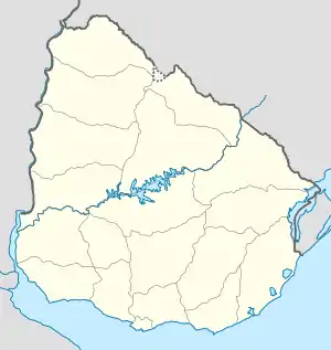
Flughafen Tacuarembó
Der Aeropuerto de Tacuarembó (IATA-Flughafencode: TAW - ICAO-Flughafencode: SUTB) ist ein Flughafen in Uruguay.
| Aeropuerto de Tacuarembó | |||
|---|---|---|---|
| |||
| Kenndaten | |||
| ICAO-Code | SUTB | ||
| IATA-Code | TAW | ||
| Koordinaten | |||
| Höhe über MSL | 134 m (440 ft) | ||
| Verkehrsanbindung | |||
| Entfernung vom Stadtzentrum | 6 km südöstlich von Tacuarembó | ||
| Start- und Landebahn | |||
| 10/28 | 1160 m × 23 m Asphalt | ||
Er liegt südöstlich der Stadt Tacuarembó und nordöstlich von Paso Bonilla, rund zwei Kilometer nordwestlich der Mündung des Arroyo Tranqueras in den Arroyo Tacuarembó Chico im Departamento Tacuarembó im zentralen Norden Uruguays.
Siehe auch
Weblinks
This article is issued from Wikipedia. The text is licensed under Creative Commons - Attribution - Sharealike. The authors of the article are listed here. Additional terms may apply for the media files, click on images to show image meta data.
