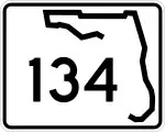
Florida State Road 134
Die Florida State Road 134 (kurz FL 134) ist eine State Route im US-Bundesstaat Florida, die in Ost-West-Richtung verläuft.

| |
|---|---|
| Basisdaten | |
| Gesamtlänge: | 11 mi/18 km |
| Bundesstaat: | Florida |
| Anfangspunkt: | |
| Endpunkt: | |
| County: | Duval |
Die State Road beginnt an der State Road 228 südwestlich von Jacksonville und endet nach 18 Kilometern in Jacksonville am U.S. Highway 17.
Verlauf
Ab der State Road 228 nördlich des Cecil Field Airports verläuft die Strecke in östlicher Richtung und trifft im Süden von Jacksonville auf die Interstate 295. Nach etwa einem Kilometer wird sie von der State Road 21 gekreuzt. Nach der Überquerung des Ortega Rivers endet die FL 134 am U.S. Highway 17 westlich des Naval Air Station Jacksonville.
This article is issued from Wikipedia. The text is licensed under Creative Commons - Attribution - Sharealike. The authors of the article are listed here. Additional terms may apply for the media files, click on images to show image meta data.