Family Islands
Die Family Islands[1] sind eine unbewohnte Inselgruppe vor der Ostküste des australischen Bundesstaats Queensland. Die Gruppe besteht aus 13 kleinen Inseln, von denen Dunk Island im Norden die größte ist.
| Family Islands | ||
|---|---|---|
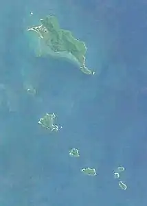 Satellitenbild der Inselgruppe | ||
| Gewässer | Korallenmeer | |
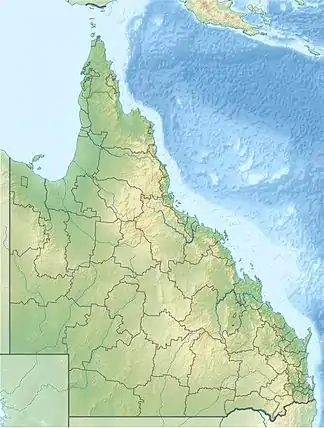
| Geographische Lage | 18° 0′ S, 146° 10′ O | |
| ||
| Anzahl der Inseln | 13 | |
| Hauptinsel | Dunk Island | |
| Einwohner | unbewohnt | |
Inseln
![]() Karte mit allen Koordinaten: OSM | WikiMap
Karte mit allen Koordinaten: OSM | WikiMap
| Inselname | Aliasname | Koordinaten | Fläche | Anmerkung |
|---|---|---|---|---|
| Purtaboi Island | Mound Island | 17° 56′ S, 146° 08′ O | … | |
| Coombe Island | Coomba | 18° 02′ S, 146° 11′ O | … | |
| Dunk Island | Coonanglebah | 17° 57′ S, 146° 09′ O | … | teilweise Privatbesitz |
| Smith Island | Kurrumbah | 18° 02′ S, 146° 12′ O | … | |
| Woln-Garin Island | 17° 58′ S, 146° 11′ O | … | ||
| Mung-Um-Gnackum Island | 17° 57′ S, 146° 09′ O | … | ||
| Wheeler Island | Toolgbar | 18° 02′ S, 146° 10′ O | … | |
| Bedarra Island | Richards Island | 18° 00′ S, 146° 09′ O | … | Touristeninsel |
| Thorpe Island | Ti mana | 17° 59′ S, 146° 08′ O | … | Privatbesitz ("Freehold") |
| Bowden Island | Budg-Joo | 18° 03′ S, 146° 12′ O | … | |
| Pee-Rahm-Ah Island | Battleship Rock | 18° 00′ S, 146° 09′ O | … | |
| Hudson Island | Coolah | 18° 03′ S, 146° 12′ O | … | |
| Kumboola Island | 17° 57′ S, 146° 08′ O | … |
Nationalpark
Einige der Inseln sind in Privatbesitz[2]. Andere Flächen der Inseln bilden den Family-Islands-Nationalpark.
Einzelnachweise
This article is issued from Wikipedia. The text is licensed under Creative Commons - Attribution - Sharealike. The authors of the article are listed here. Additional terms may apply for the media files, click on images to show image meta data.