El Pinar (Uruguay)
El Pinar ist eine Stadt in Uruguay, die mittlerweile in der Ciudad de la Costa aufgegangen ist.
| El Pinar | ||
|---|---|---|
|
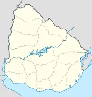
El Pinar auf der Karte von Uruguay | ||
| Basisdaten | ||
| Staat | Uruguay | |
| Departamento | Canelones | |
| Einwohner | 21.091 (2011) | |
| Detaildaten | ||
| Postleitzahl | 15008[1] | |
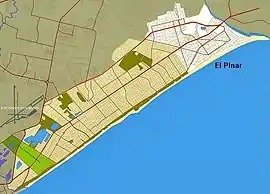 Lage von El Pinar in der Ciudad de la Costa | ||
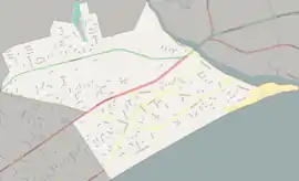 Plan von El Pinar | ||
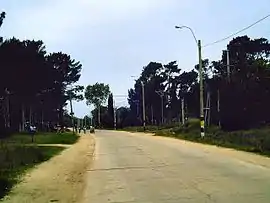 Calle Pérez Butler in El Pinar | ||
Geographie
Sie befindet sich im Süden des Departamento Canelones in dessen Sektor 37 an der Küste des Río de la Plata. Westlich grenzt Lomas de Solymar an, östlich liegt Neptunia und im Norden ist Country Villa Juana gelegen.
Infrastruktur
Durch El Pinar, in dessen Nordteil die Rennstrecke Autódromo Víctor Borrat Fabini gelegen ist, führt die Ruta Interbalnearia.
Einwohner
Die Einwohnerzahl von El Pinar beträgt 21.091. (Stand: 2011)[2]
| Jahr | Einwohner |
|---|---|
| 1963 | 394 |
| 1975 | 1.874 |
| 1985 | 3.479 |
| 1996 | 10.383 |
| 2004 | 17.221 |
| 2011 | 21.091 |
Weblinks
Commons: El Pinar, Canelones – Sammlung von Bildern
Einzelnachweise
- Códigos Postales del Interior
- Statistische Daten des Instituto Nacional de Estadística de Uruguay, abgerufen am 31. Oktober 2013
- Statistische Daten des Instituto Nacional de Estadística de Uruguay 1963–1996 (DOC; 74 kB)
- Statistische Daten des Instituto Nacional de Estadística de Uruguay – Stand 2004 (MS Excel; 75 kB), abgerufen am 24. Oktober 2010
This article is issued from Wikipedia. The text is licensed under Creative Commons - Attribution - Sharealike. The authors of the article are listed here. Additional terms may apply for the media files, click on images to show image meta data.