Craggy Island (Südliche Shetlandinseln)
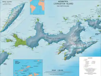
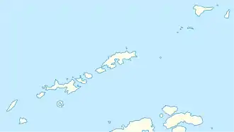
Craggy Island (von englisch craggy ‚felsig, schroff, zerklüftet‘, in Argentinien und Chile gleichbedeutend Islote Escarpado) ist eine schmale, durch Felsvorsprünge gekennzeichnete Insel im Archipel der Südlichen Shetlandinseln. Sie liegt nahe der Ostseite von Desolation Island und bildet die nordöstliche Begrenzung der Blythe Bay.
| Craggy Island | ||
|---|---|---|
 Karte von Livingston Island (Mitte) mit der nördlich gelegenen Hero Bay, Desolation Island und der benachbarten Insel Craggy Island | ||
| Gewässer | Drakestraße | |
| Inselgruppe | Südliche Shetlandinseln | |
| Geographische Lage | 62° 28′ S, 60° 18′ W | |
| ||
| Einwohner | unbewohnt | |
Wissenschaftler der britischen Discovery Investigations kartierten sie 1935 und gaben ihr ihren deskriptiven Namen.
Weblinks
- Craggy Island im Geographic Names Information System des United States Geological Survey (englisch)
- Craggy Island auf geographic.org (englisch)
This article is issued from Wikipedia. The text is licensed under Creative Commons - Attribution - Sharealike. The authors of the article are listed here. Additional terms may apply for the media files, click on images to show image meta data.
