Copper Cove
Die Copper Cove (englisch für Kupferbucht) ist eine Bucht an der Borchgrevink-Küste des ostantarktischen Viktorialands. Sie liegt auf der Ostseite des Honeycomb Ridge am Westufer der Moubray Bay.
| Copper Cove | ||
|---|---|---|
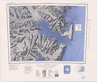 Topografische Karte mit der Moubray Bay und der Copper Cove (rechts oben) Topografische Karte mit der Moubray Bay und der Copper Cove (rechts oben) | ||
| Gewässer | Moubray Bay, Rossmeer | |
| Landmasse | Viktorialand, Ostantarktika | |
| Geographische Lage | 72° 9′ 0″ S, 170° 0′ 0″ O | |
| ||

Teilnehmer einer von 1957 bis 1958 dauernden Kampagne im Rahmen der New Zealand Geological Survey Antarctic Expedition benannten sie nach auffällig grünen Färbung in den Uferkliffs, die durch kupferbasierten Grünspan hervorgerufen wird.
Weblinks
- Copper Cove im Geographic Names Information System des United States Geological Survey (englisch)
- Copper Cove auf geographic.org (englisch)
This article is issued from Wikipedia. The text is licensed under Creative Commons - Attribution - Sharealike. The authors of the article are listed here. Additional terms may apply for the media files, click on images to show image meta data.