Cook Bay
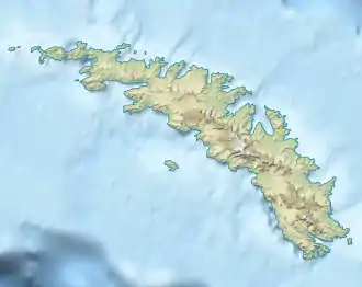
Die Cook Bay ist eine unregelmäßig geformte Bucht an der Nordküste von Südgeorgien. Ihre Einfahrt wird vom Kap Crewe und vom Black Head markiert. Nach Westen spaltet sie sich auf in die Lighthouse Bay und den Prince Olav Harbour.
| Cook Bay | ||
|---|---|---|
| Gewässer | Südatlantik | |
| Landmasse | Südgeorgien | |
| Geographische Lage | 54° 3′ 31″ S, 37° 7′ 28″ W | |
| ||
| Breite | 2,1 km | |
Kartiert wurde sie von Wissenschaftlern der britischen Discovery Investigations zwischen 1926 und 1930. Benannt ist sie nach dem britischen Seefahrer und Entdecker James Cook (1728–1779), der 1775 in der Bucht anlandete.
Weblinks
- Cook Bay im Geographic Names Information System des United States Geological Survey (englisch)
- Cook Bay auf geographic.org (englisch)
This article is issued from Wikipedia. The text is licensed under Creative Commons - Attribution - Sharealike. The authors of the article are listed here. Additional terms may apply for the media files, click on images to show image meta data.
