Colorado State Highway 10
Der Colorado State Highway 10 ist ein in Nord-Süd-Richtung verlaufender Highway im US-Bundesstaat Colorado.

| |
|---|---|
| Karte | |
 | |
| Basisdaten | |
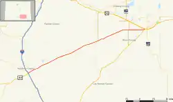
| Gesamtlänge: | 72 Meilen / 116 Kilometer |
| Anfangspunkt: | |
| Endpunkt: | |
| Countys: | Huerfano County Las Animas County Pueblo County Otero County |
Der Highway beginnt an der Interstate 25 und am U.S. Highway 160 in Walsenburg und endet in La Junta am U.S. Highway 50. Bei Hawley trifft der State Highway auf den Colorado State Highway 71.
Weblinks
Commons: Colorado State Highway 10 – Sammlung von Bildern, Videos und Audiodateien
This article is issued from Wikipedia. The text is licensed under Creative Commons - Attribution - Sharealike. The authors of the article are listed here. Additional terms may apply for the media files, click on images to show image meta data.