Chacras de Dolores
Chacras de Dolores ist eine Stadt im Westen Uruguays.
| Chacras de Dolores | ||
|---|---|---|
|
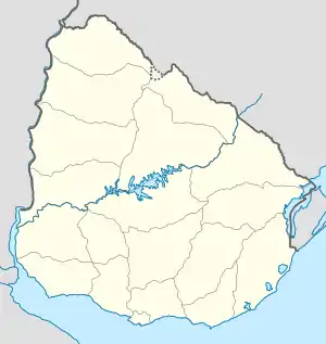
Chacras de Dolores auf der Karte von Uruguay | ||
| Basisdaten | ||
| Staat | Uruguay | |
| Departamento | Soriano | |
| Einwohner | 3251 (2004) | |
| Detaildaten | ||
Geographie
Sie befindet sich im westlichen Teil des Departamento Soriano in dessen Sektor 3. Chacras de Dolores, am Río San Salvador gelegen, umschließt die Stadt Dolores an deren dem Fluss abgewandten Gebiet. Sie liegt südöstlich an Villa Soriano bzw. La Loma, östlich La Concordias und nordöstlich von Colonia Concordia.
Infrastruktur
Die Ruta 96 und die Ruta 21 führen durch die Stadt.
Einwohner
Chacras de Dolores hatte bei der Volkszählung im Jahre 2004 3.251 Einwohner.[1]
| Jahr | Einwohner |
|---|---|
| 1963 | - |
| 1975 | - |
| 1985 | - |
| 1996 | 2.337 |
| 2004 | 3.251 |
Quelle: Instituto Nacional de Estadística de Uruguay[2]
Weblinks
Einzelnachweise
This article is issued from Wikipedia. The text is licensed under Creative Commons - Attribution - Sharealike. The authors of the article are listed here. Additional terms may apply for the media files, click on images to show image meta data.
