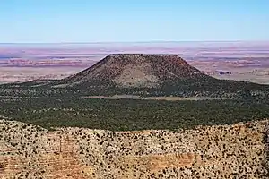
Cedar Mountain (Grand-Canyon-Nationalpark, Arizona)
Der Cedar Mountain ist ein Tafelberg am Rande des Grand-Canyon-Nationalparks im Coconino County des US-amerikanischen Bundesstaates Arizona. Er ist 2146 Meter hoch.
| Cedar Mountain | ||
|---|---|---|
Cedar Mountain | ||
| Höhe | 2146 m | |
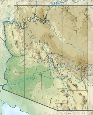
| Lage | Arizona, USA | |
| Koordinaten | 36° 3′ 11″ N, 111° 46′ 20″ W | |
| ||
Der Cedar Mountain liegt zwischen Grand Canyon Village und Tuba City. Der Colorado River ist etwa acht Kilometer entfernt, die Arizona State Route 64 etwa fünf Kilometer.
This article is issued from Wikipedia. The text is licensed under Creative Commons - Attribution - Sharealike. The authors of the article are listed here. Additional terms may apply for the media files, click on images to show image meta data.