Cadenazzi Rock
Der Cadenazzi Rock ist eine Felsformation im westantarktischen Marie-Byrd-Land. Am Westhang des Mount Takahe ragt er 2,5 km östlich des Roper Point auf.
| Cadenazzi Rock | ||
|---|---|---|
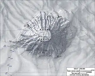
Topografische Karte des Mount Takahe mit dem Cadenazzi Rock (links) | ||
| Lage | Marie-Byrd-Land, Westantarktika | |
| Gebirge | Mount-Takahe-Massiv | |
| Koordinaten | 76° 18′ 0″ S, 112° 39′ 0″ W | |
| ||

Der United States Geological Survey kartierte ihn anhand eigener Vermessungen und Luftaufnahmen der United States Navy aus den Jahren von 1959 bis 1966. Das Advisory Committee on Antarctic Names benannte ihn 1975 nach Michael P. Cadenazzi (* 1947), Pilot eines Sikorsky S-58 für den Mannschaftstransport im Rahmen des United States Antarctic Research Program in den antarktischen Sommerkampagnen zwischen 1969 und 1970 sowie von 1970 bis 1971.
Weblinks
- Cadenazzi Rock im Geographic Names Information System des United States Geological Survey (englisch)
- Cadenazzi Rock auf geographic.org (englisch)
This article is issued from Wikipedia. The text is licensed under Creative Commons - Attribution - Sharealike. The authors of the article are listed here. Additional terms may apply for the media files, click on images to show image meta data.