Brodribb River
Der Brodribb River ist ein Fluss im östlichen Gippsland im australischen Bundesstaat Victoria.
| Brodribb River | ||
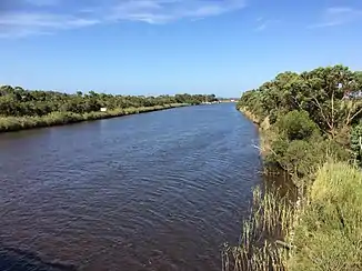 Brodribb River an der Brücke bei Marlo Brodribb River an der Brücke bei Marlo | ||
| Daten | ||
| Lage | Victoria, Australien | |
| Flusssystem | Snowy River | |
| Abfluss über | Snowy River → Bass Strait | |
| Quelle | Mount Ellery im Errinundra-Nationalpark 37° 19′ 13″ S, 148° 45′ 31″ O | |
| Quellhöhe | 334 m | |
| Mündung | Bei Tabbara in den Snowy River 37° 46′ 38″ S, 148° 31′ 41″ O | |
| Mündungshöhe | 3 m[1] | |
| Höhenunterschied | 331 m | |
| Sohlgefälle | 3,2 ‰ | |
| Länge | 105 km[1] | |
| Linke Nebenflüsse | Brodribb River South Branch, Ellery Creek, B. A. Creek, Ferntree Creek, Big River, Rich River, Tooti Creek, Jack River, Cabbage Tree Creek | |
| Rechte Nebenflüsse | Brodribb River North Branch, Goongerah Creek, Joy Creek, Dead Bull Creek, Dad Calf Creek, Ironbank Creek, Martin Creek, Sardine Creek, Wild Cow Creek, Dynamite Creek, Gravelly Creek, Camp Creek, Fat Cow Creek | |
| Durchflossene Stauseen | Lake Curlip | |
| Kleinstädte | Tabbara | |
Verlauf
Er entsteht durch Zusammenfluss der beiden Quellflüsse Brodribb River North Branch und Brodribb River South Branch westlich des Errinundra-Nationalparks. Beide Quellflüsse entspringen im Park, Letzterer unterhalb des Mount Ellery.
Der Brodribb River fließt 105 Kilometer durch das größtenteils unbesiedelte Gebirgsvorland nach Süden und mündet bei Tabbara in der Nähe Orbost in den Snowy River. Kurz vor seiner Mündung durchfließt er den Lake Curlip.
Einzelnachweise
- Map of Brodribb River. Bonzle.com
- Janette Finch & Ruth Teale: Brodribb, William Adams (1809–1886). Adbonline.anu.edu.au (1969)
- Les Blake: Place Names of Victoria. Rigby (1977). ISBN 0727002503. S. 294. zitiert in: Eric Bird: The Australian National Placename Survey (ANPS) – Place Names on the Coast of Victoria (Memento vom 4. März 2011 auf WebCite) – 12. Oktober 2006, anps.org.au, englisch (PDF; 157 kB)
This article is issued from Wikipedia. The text is licensed under Creative Commons - Attribution - Sharealike. The authors of the article are listed here. Additional terms may apply for the media files, click on images to show image meta data.