Baia de Atecru
Die Baia de Atecru liegt an der Bandasee, an der Westküste der zu Osttimor gehörenden Insel Atauro. Die Bucht ist nach dem in ihr liegendem Dorf Atecru benannt. Westlich wird die Bucht durch das Kap Ponta Tutolo begrenzt.[1] Vor der Küste liegt ein Riff.[2]
| Baia de Atecru Bucht von Atecru | ||
|---|---|---|
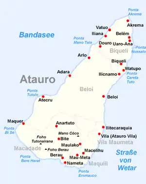 Karte von Atauro Karte von Atauro | ||
| Gewässer | Bandasee | |
| Landmasse | Timor | |
| Geographische Lage | 8° 13′ 14″ S, 125° 32′ 49″ O | |
| ||
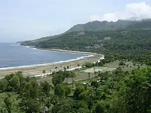 Blick über das Dorf Atecru an der gleichnamigen Bucht Blick über das Dorf Atecru an der gleichnamigen Bucht | ||
Einzelnachweise
This article is issued from Wikipedia. The text is licensed under Creative Commons - Attribution - Sharealike. The authors of the article are listed here. Additional terms may apply for the media files, click on images to show image meta data.