Atlantic Intracoastal Waterway
Der Atlantic Intracoastal Waterway ist eine 4.800 km lange Küstenwasserstraße entlang der Atlantikküste und Golfküste in den Vereinigten Staaten. Er reicht von Florida bis nach Boston in Massachusetts und dient sowohl kommerziellen Zwecken als auch zur Erholung. Die Nutzung der Wasserstraße ist kostenlos, kommerzielle Nutzer entrichten jedoch eine sogenannte Fuel Tax.

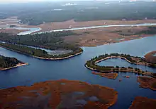
Der Atlantic Intracoastal Waterway in Pamlico County, North Carolina

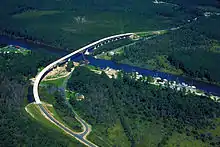
Kreuzung des Atlantic Intracoastal Waterways mit dem Ausflusskanal des Kernkraftwerks Brunswick, Brunswick County, North Carolina
Der Atlantic Intracoastal Waterway besteht aus natürlichen Kanälen, Salzwasserflüssen, Buchten und künstlich angelegten Kanälen.
Teile des Atlantic Intracoastal Waterways
Natürliche Buchten und Seen
- Albemarle Sound
- Barnegat Bay
- Biscayne Bay
- Buzzards Bay
- Cape Cod Bay
- Casco Bay
- Chesapeake Bay
- Delaware Bay
- East River
- Gulf of Maine
- Halifax River
- Indian River Lagoon
- Long Island Sound
- Pamlico Sound
Kanäle
- Chesapeake and Delaware Ship Canal
- Cape Cod Canal
- Dismal Swamp Canal
- Delaware and Raritan Canal
- Point Pleasant Canal
- Waccamaw River in South Carolina
- Winyah Bay in South Carolina
- Little River Inlet in South Carolina
Siehe auch
Weblinks
Commons: Atlantic Intracoastal Waterway – Sammlung von Bildern, Videos und Audiodateien
- US Army Corps of Engineers - Atlantic Intracoastal Waterway information site (englisch)
- Atlantic Intracoastal Waterway Association (englisch)
- Elizabeth City Area Convention & Visitors Bureau (englisch)
- Gulf Intracoastal Canal Association (englisch)
- Gulf Intracoastal Waterway at Handbook of Texas (englisch)
This article is issued from Wikipedia. The text is licensed under Creative Commons - Attribution - Sharealike. The authors of the article are listed here. Additional terms may apply for the media files, click on images to show image meta data.