Arizona State Route 97
Die Arizona State Route 97 (kurz AZ 97) ist eine State Route im US-Bundesstaat Arizona, der in Nord-Süd-Richtung verläuft.

| |
|---|---|
| Karte | |
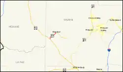 | |
| Basisdaten | |
| Gesamtlänge: | 11 mi/16 km |
| Eröffnung: | 1964 |
| Anfangspunkt: | |
| Endpunkt: | |
| County: | Yavapai County |
Die State Route beginnt an der Arizona State Route 96 südöstlich von Bagdad sowie nordwestlich von Wickenburg und endet in den Santa Maria Mountains am U.S. Highway 93.
Weblinks
Commons: Arizona State Route 97 – Sammlung von Bildern, Videos und Audiodateien
- Arizona Roads (englisch)
- AARoads (englisch)
This article is issued from Wikipedia. The text is licensed under Creative Commons - Attribution - Sharealike. The authors of the article are listed here. Additional terms may apply for the media files, click on images to show image meta data.