Arachania (Rocha)
Arachania ist eine Ortschaft im Südosten Uruguays.
| Arachania | ||
|---|---|---|
|
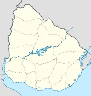
Arachania auf der Karte von Uruguay | ||
| Basisdaten | ||
| Staat | Uruguay | |
| Departamento | Rocha | |
| Einwohner | 377 (20011) | |
| Detaildaten | ||
| Postleitzahl | 27002 | |
Geographie
Sie befindet sich auf dem Gebiet des Departamento Rocha in dessen Sektor 10. Sie liegt an der Atlantikküste südwestlich von La Pedrera und nordöstlich von La Aguada y Costa Azul.
Infrastruktur
Arachania liegt an der Ruta 10.
Einwohner
Arachania hatte bei der Volkszählung im Jahr 2011 377 Einwohner, davon 201 männliche und 176 weibliche.[1]
| Jahr | Einwohner |
|---|---|
| 1963 | - |
| 1975 | 39 |
| 1985 | 68 |
| 1996 | 203 |
| 2004 | 335 |
| 2011 | 377 |
Weblinks
- Stadtplan von Arachania (PDF; 106 kB)
Einzelnachweise
This article is issued from Wikipedia. The text is licensed under Creative Commons - Attribution - Sharealike. The authors of the article are listed here. Additional terms may apply for the media files, click on images to show image meta data.
