Alberta Highway 7
Der Alberta Highway 7 ist ein 26 Kilometer langer Highway von Black Diamond bis Okotoks.[1] Er verbindet den westlich gelegenen Alberta Highway 22 mit dem östlicher gelegenem Alberta Highway 2 und wird dabei ein kurzes Teilstück gemeinsam mit dem Alberta Highway 2A geführt.
| Highway 7 in Alberta, Kanada | |||||||||||||
 | |||||||||||||
| Karte | |||||||||||||
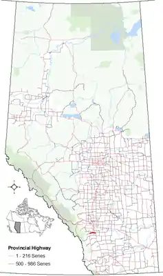 Verlauf der H 7 | |||||||||||||
| Basisdaten | |||||||||||||
| Betreiber: | Alberta Transportation | ||||||||||||
| Straßenbeginn: | Black Diamond (50° 41′ 18″ N, 114° 13′ 58″ W) | ||||||||||||
| Straßenende: | östlich von Okotoks (50° 41′ 49″ N, 113° 52′ 56″ W) | ||||||||||||
| Gesamtlänge: | 26 km | ||||||||||||
Straßenverlauf
| |||||||||||||
Einzelnachweise
- Alberta Highways 1 to 986, traffic volume, vehicle classification, travel and esal statistic reports. (PDF, 581 KB) Government of Alberta - Ministry of Transportation, 2012, S. 9f, abgerufen am 8. April 2013 (englisch).
|
1 | 2 | 3 | 4 | 5 | 6 | 7 | 8 | 9 | 10 | 11 | 12 | 13 | 14 | 15 | 16 | 17 | 18 | 19 | 20 | 21 | 22 | 23 | 24 | 25 | 26 | 27 | 28 | 29 | 31 | 32 | 33 | 35 | 36 | 37 | 38 | 39 | 40 | 41 | 42 | 43 | 44 | 45 | 47 | 49 | 50 | 52 | 53 | 54 | 55 | 56 | 58 | 59 | 60 | 61 | 62 | 63 | 64 | 66 | 68 | 69 | 72 | 88 | 93 | 100 | 201 | 216 | |||
|
1A | 1X | 2A | 3A | 11A | 13A | 16A | 20A | 22X | 28A | 41A | 64A | 93A | |||
This article is issued from Wikipedia. The text is licensed under Creative Commons - Attribution - Sharealike. The authors of the article are listed here. Additional terms may apply for the media files, click on images to show image meta data.