Île Howe
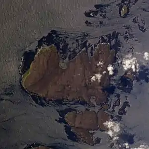
Île Howe ist die drittgrößte Insel des französischen Kerguelen-Archipels im südlichen Indischen Ozean. Sie wurde im Jahr 1772 entdeckt. Die Insel ist vulkanischen Ursprungs und unbewohnt.
| Île Howe | ||
|---|---|---|
 | ||
| Gewässer | Indischer Ozean | |
| Inselgruppe | Kerguelen | |
| Geographische Lage | 48° 52′ 0″ S, 69° 27′ 0″ O | |
| ||
| Länge | 8 km | |
| Fläche | 51 km² | |
| Höchste Erhebung | Mont des Moutons 245 m | |
| Einwohner | unbewohnt | |
Geographie
Île Howe hat eine Länge von 8 km und weist eine Fläche von 51 km² auf.[1] Die höchste Erhebung ist der Mont des Moutons mit 245 m über dem Meer.[2]
Einzelnachweise
- Roger Brunet: Tableau général de la France d’outre-mer. In: Mappemonde. Nr. 54, 1999, Terres australes et antarctiques françaises (TAAF), S. 43 (französisch, online [PDF; 43 kB; abgerufen am 15. Mai 2017]).
- Îles Kerguelen. Topographische Karte 1:200.000. In: Géoportail. Institut national de l’information géographique et forestière (IGN), abgerufen am 15. Mai 2017 (französisch).
This article is issued from Wikipedia. The text is licensed under Creative Commons - Attribution - Sharealike. The authors of the article are listed here. Additional terms may apply for the media files, click on images to show image meta data.