Île Béniguet
Die Île Béniguet ist eine französische Insel in der Region Bretagne und im Département Côtes-d’Armor und liegt im Ärmelkanal, der Halbinsel Bretagne vorgelagert. Sie hat eine Fläche von 18 Hektar, ihr höchster Punkt liegt 27 Meter über dem Meer.
| Île Béniguet | ||
|---|---|---|
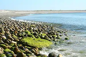 Nordostküste | ||
| Gewässer | Ärmelkanal | |
| Geographische Lage | 48° 50′ 33″ N, 3° 1′ 6″ W | |
| ||
| Fläche | 18 ha | |
| Höchste Erhebung | 27 m | |
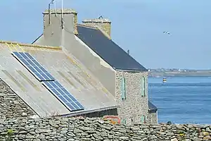 Farm auf der Insel | ||
Verwaltungsmäßig gehört die Insel zur Gemeinde Île de Bréhat.
Eine gleichnamige Insel liegt im Archipel der Île-Molène im Département Finistère
Weblinks
Commons: Île Béniguet – Sammlung von Bildern, Videos und Audiodateien
This article is issued from Wikipedia. The text is licensed under Creative Commons - Attribution - Sharealike. The authors of the article are listed here. Additional terms may apply for the media files, click on images to show image meta data.