Tunø Fyr
Tunø Fyr ist ein Leuchtturm in Dänemark auf dem Kirchturm der Tunø Kirke auf der Insel Tunø in der Århusbucht. Es begrenzt das südliche Ende der Ost-West-Durchfahrt zwischen der Halbinsel Mols im Norden und den Inseln Samsø und Tunø im Süden.
| Tunø Fyr | ||
|---|---|---|
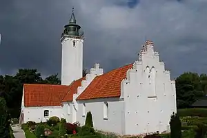 Tunø Fyr auf dem Kirchturm (2000) | ||
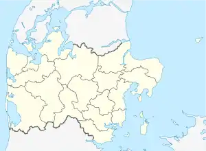
| Ort: | Insel Tunø | |
| Lage: | Kirchturmspitze | |
| Geographische Lage: | 55° 56′ 58,3″ N, 10° 26′ 37,1″ O | |
| Feuerträgerhöhe: | 18 | |
| Feuerhöhe: | 31 | |
| ||
| Kennung: | Oc./Ubr. WRG 5s | |
| Betriebsart: | elektrisch | |
| Funktion: | Seefeuer | |
| Bauzeit: | 1801 | |
| Betriebszeit: | seit 1801 | |
| Internationale Ordnungsnummer: | C 0822 | |
Weblinks
This article is issued from Wikipedia. The text is licensed under Creative Commons - Attribution - Sharealike. The authors of the article are listed here. Additional terms may apply for the media files, click on images to show image meta data.