Tlapanaloya
Tlapanaloya ist ein Ort im mexikanischen Bundesstaat México mit etwa 6.500 Einwohnern, der zum Municipio Tequixquiac gehört.
| Tlapanaloya | ||
|---|---|---|
|
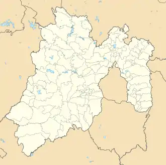
Tlapanaloya auf der Karte von México | ||
| Basisdaten | ||
| Staat | Mexiko | |
| Bundesstaat | México | |
| Municipio | Tequixquiac | |
| Einwohner | 6466 (2010) | |
| Stadtinsignien | ||
 | ||
| Detaildaten | ||
| Höhe | 2250 m | |
| Postleitzahl | 55653 | |
| Vorwahl | (+52) 599 | |
| Zeitzone | UTC−6 | |
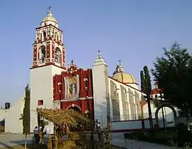 Auferstehungs-Kirche in Tlapanaloya | ||
Der Name Tlapanaloya kommt aus dem Nahuatl-Begriff Tetlapanaloyan, abgeleitet von tetl ‚Stein‘, tlapana ‚gebrochen‘ und -loyan ‚Ort, Stelle‘, also in etwa "Ort des gebrochenen Steins".
Weblinks
Commons: Tlapanaloya – Sammlung von Bildern, Videos und Audiodateien
This article is issued from Wikipedia. The text is licensed under Creative Commons - Attribution - Sharealike. The authors of the article are listed here. Additional terms may apply for the media files, click on images to show image meta data.