Stickle Ghyll
Der Stickle Ghyll ist ein Wasserlauf im Lake District, Cumbria, England.
| Stickle Ghyll | ||
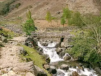 Brücke über den Stickle Ghyll Brücke über den Stickle Ghyll | ||
| Daten | ||
| Lage | Lake District in Cumbria in NW-England | |
| Flusssystem | River Leven | |
| Abfluss über | Great Langdale Beck → River Brathay → River Rothay → River Leven → Irische See | |
| Quelle | Abfluss des Stickle Tarn 54° 27′ 28″ N, 3° 6′ 0″ W | |
| Quellhöhe | 473 m ASL | |
| Mündung | in den Great Langdale Beck 54° 26′ 54″ N, 3° 5′ 5″ W
| |
Der Stickle Ghyll entsteht als Abfluss des Stickle Tarn am nördlichen Rand des Great Langdale Tals. Er fließt in südlicher Richtung bis zu seiner Mündung in den Great Langdale Beck.
Quellen
- Penrith & Keswick, Ambleside (= Landranger Map. Band 90). Ordnance Survey, Southampton 2011, ISBN 978-0-319-23206-4.
This article is issued from Wikipedia. The text is licensed under Creative Commons - Attribution - Sharealike. The authors of the article are listed here. Additional terms may apply for the media files, click on images to show image meta data.