Sombre Point
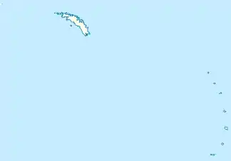
Der Sombre Point (englisch für Düstere Landspitze) ist eine Landspitze im Nordwesten von Saunders Island im Archipel der Südlichen Sandwichinseln. Sie markiert das nordwestliche Ende der Cordelia Bay.
| Sombre Point | ||
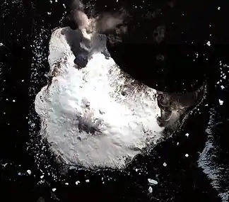 Saunders Island mit dem Sombre Point (oben rechts) | ||
| Geographische Lage | ||
| ||
| Koordinaten | 57° 46′ S, 26° 27′ W | |
| Lage | Saunders Island (Südliche Sandwichinseln) | |
| Gewässer | Südatlantik | |
| Gewässer 2 | Cordelia Bay | |
Das UK Antarctic Place-Names Committee benannte sie 1971 nach dem dunklen Basalt und der Vulkanasche in diesem Gebiet.
Weblinks
- Sombre Point im Geographic Names Information System des United States Geological Survey (englisch)
- Sombre Point auf geographic.org (englisch)
This article is issued from Wikipedia. The text is licensed under Creative Commons - Attribution - Sharealike. The authors of the article are listed here. Additional terms may apply for the media files, click on images to show image meta data.