Robinson Heights
Die Robinson Heights sind ein hauptsächlich vereistes und bis zu 2170 m hohes Gebirge im Norden des ostantarktischen Viktorialands. Mit einer Länge von 24 km hat es in der Aufsicht eine elliptische Form. Das Gebirge ragt südlich des Anare-Passes auf und bildet das nordwestliche Ende der Admiralitätsberge.
| Robinson Heights | ||
|---|---|---|
| Lage | Viktorialand, Ostantarktika | |
| Teil der | Admiralitätsberge im Transantarktischen Gebirge | |
| ||
| Koordinaten | 71° 22′ S, 166° 40′ O | |
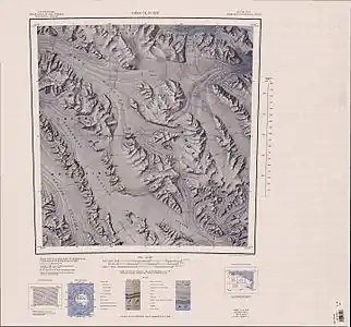
 Topografische Karte mit den Robinson Heights (obere Mitte) Topografische Karte mit den Robinson Heights (obere Mitte) | ||
Das Advisory Committee on Antarctic Names nahm 1964 die Benennung vor. Namensgeber ist der US-amerikanische Geophysiker Edwin S. Robinson (1935–2020), der 1960 im Rahmen des United States Antarctic Research Program auf der McMurdo-Station tätig war und 1962 bis 1963 an einem Erkundungsmarsch zur Amundsen-Scott-Südpolstation teilgenommen hatte.
Weblinks
- Robinson Heights im Geographic Names Information System des United States Geological Survey (englisch)
- Robinson Heights auf geographic.org (englisch)
This article is issued from Wikipedia. The text is licensed under Creative Commons - Attribution - Sharealike. The authors of the article are listed here. Additional terms may apply for the media files, click on images to show image meta data.
