Palmer Bay
Die Palmer Bay ist eine 1,5 km breite Bucht an der Nordküste von Coronation Island im Archipel der Südlichen Orkneyinseln. Sie liegt unmittelbar westlich des Crown Head.
| Palmer Bay | ||
|---|---|---|
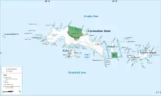 Karte von Coronation Island (Mitte) mit der Palmer Bay Karte von Coronation Island (Mitte) mit der Palmer Bay | ||
| Gewässer | Scotiasee | |
| Landmasse | Coronation Island, Südliche Orkneyinseln | |
| Geographische Lage | 60° 37′ 44″ S, 45° 20′ 17″ W | |
| ||
| Breite | 1,5 km | |

Der britische Robbenfängerkapitän George Powell und sein US-amerikanisches Pendant Nathaniel Palmer, nach dem die Bucht benannt ist, entdeckten sie gemeinsam im Dezember 1821.
Weblinks
- Palmer Bay im Geographic Names Information System des United States Geological Survey (englisch)
- Palmer Bay auf geographic.org (englisch)
This article is issued from Wikipedia. The text is licensed under Creative Commons - Attribution - Sharealike. The authors of the article are listed here. Additional terms may apply for the media files, click on images to show image meta data.