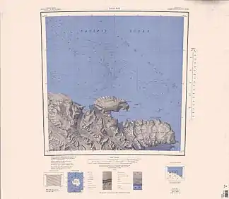
Nielsen-Fjord
Der Nielsen-Fjord ist ein rund 4 km breiter Fjord an der Pennell-Küste im Norden des ostantarktischen Viktorialands. Er liegt zwischen Cape North und den Gregory Bluffs.
| Nielsen-Fjord | ||
|---|---|---|
 Topografische Karte mit dem Nielsen-Fjord (links der Mitte) Topografische Karte mit dem Nielsen-Fjord (links der Mitte) | ||
| Gewässer | Somow-See | |
| Landmasse | Viktorialand, Ostantarktika | |
| Geographische Lage | 70° 42′ 0″ S, 165° 50′ 0″ O | |
| ||
| Breite | ca. 4 km | |
| Zuflüsse | McMahon-Gletscher | |
Er wurde im Zuge der Australian National Antarctic Research Expeditions nach Kapitän Hans Nielsen benannt, Schiffsführer der Thala Dan zur Küstenvermessung im Jahr 1962.
Weblinks
- Nielsen-Fjord im Geographic Names Information System des United States Geological Survey (englisch)
- Nielsen-Fjord auf geographic.org (englisch)
This article is issued from Wikipedia. The text is licensed under Creative Commons - Attribution - Sharealike. The authors of the article are listed here. Additional terms may apply for the media files, click on images to show image meta data.
