Nationalpark Barranca del Cupatitzio
Der Nationalpark Barranca del Cupatitzio umfasst das Quellgebiet des Flusses Rio Cupatitzio im Bundesstaat Michoacán in Mexiko.
Nationalpark Barranca del Cupatitzio
| ||
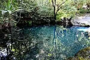
 Teich im Nationalpark (2015) Teich im Nationalpark (2015) | ||
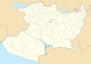
| Lage | Michoacán, Mexiko | |
| Fläche | 4,58 km² | |
| WDPA-ID | 306778 | |
| Geographische Lage | 19° 26′ N, 102° 6′ W | |
| ||
| Meereshöhe | von 1648 m bis 2238 m | |
| Einrichtungsdatum | 2. November 1938 | |
Der Nationalpark wurde 1938 als Erholungsgebiet im nordwestlichen Teil von Uruapan eingerichtete. Er besteht aus zwei Teilflächen, etwa vier Quadratkilometer westlich der Stadt und 0,5 km² mitten in der Stadt. Heute wird der Park stark touristisch vermarktet.
Das insgesamt 4,58 km² große Gebiet wurde 1996 von der IUCN in der Kategorie II anerkannt.[1]
Weblinks
Commons: Barranca de Cupatitzio National Park – Sammlung von Bildern, Videos und Audiodateien
This article is issued from Wikipedia. The text is licensed under Creative Commons - Attribution - Sharealike. The authors of the article are listed here. Additional terms may apply for the media files, click on images to show image meta data.
