Murray Foreland
Das Murray Foreland ist eine vereiste, 30 km lange und 16 km breite Halbinsel an der Bakutis-Küste des westantarktischen Marie-Byrd-Lands. Sie bildet den nordwestlichen Seitenarm der Martin-Halbinsel.
| Murray Foreland | ||
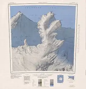 Topografische Karte der Martin-Halbinsel mit dem Murray Foreland (oben links) | ||
| Geographische Lage | ||
| ||
| Koordinaten | 74° 0′ S, 114° 30′ W | |
| Gewässer 1 | Amundsen-See, Südlicher Ozean | |
| Länge | 30 km | |
| Breite | 16 km | |

Der United States Geological Survey kartierte die Landspitze erstmals anhand von Luftaufnahmen der United States Navy bei der Operation Highjump (1946–1947) vom Januar 1947. Das Advisory Committee on Antarctic Names benannte sie nach dem US-amerikanischen Geologen Grover Elmer Murray (1916–2003), ab 1964 im Vorstand der National Science Foundation und von 1966 bis 1976 Präsident der Texas Tech University.
Weblinks
- Murray Foreland im Geographic Names Information System des United States Geological Survey (englisch)
- Murray Foreland auf geographic.org (englisch)
This article is issued from Wikipedia. The text is licensed under Creative Commons - Attribution - Sharealike. The authors of the article are listed here. Additional terms may apply for the media files, click on images to show image meta data.