Mount Steere
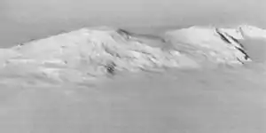
Der Mount Steere ist ein erloschener Schildvulkan in den Crary Mountains des westantarktischen Marie-Byrd-Lands. Mit einer Höhe von 3558 m und einem Alter von ungefähr 8,5 Mio. Jahren[1] ist er der zweithöchste und zweitälteste Berg des Gebirges. Er ragt 6,4 km nordnordwestlich des Mount Frakes auf.

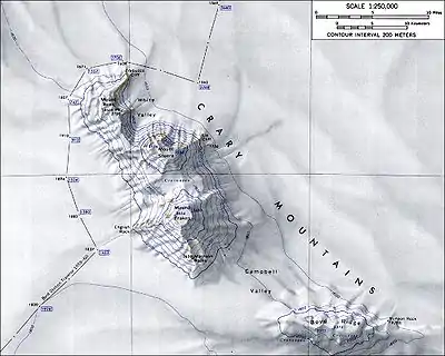
Topographische Karte von Mount Steere (Maßstab 1:250.000)
| Mount Steere | ||
|---|---|---|
 | ||
| Höhe | 3558 m | |
| Lage | Marie-Byrd-Land, Westantarktika | |
| Gebirge | Crary Mountains | |
| Koordinaten | 76° 44′ 0″ S, 117° 49′ 0″ W | |
| ||
| Typ | Schildvulkan, erloschen | |
Der United States Geological Survey kartierte ihn anhand eigener Vermessungen und Luftaufnahmen der United States Navy aus den Jahren von 1959 bis 1966. Das Advisory Committee on Antarctic Names (ACAN) benannte ihn 1967 nach dem Biologen William C. Steere (1907–1989), der von 1964 bis 1965 auf der McMurdo-Station tätig war.
Weblinks
- Mount Steere im Geographic Names Information System des United States Geological Survey (englisch).
- Skiing the Pacific Ring of Fire and Beyond: Mount Steere. In: skimountaineer.com. Amar Andalkar (englisch).
Einzelnachweise
- Kurt S. Panter et al.: Geochemistry of Late Cenozoic basalts from the Crary Mountains: characterization of mantle sources in Marie Byrd Land, Antarctica. In: Chemical Geology. Band 165, Nr. 3–4, April 2000, ISSN 0009-2541, S. 215–241, doi:10.1016/S0009-2541(99)00171-0 (englisch, online frei verfügbar durch researchgate.net).
This article is issued from Wikipedia. The text is licensed under Creative Commons - Attribution - Sharealike. The authors of the article are listed here. Additional terms may apply for the media files, click on images to show image meta data.
