Mount Hart
Mount Hart ist ein über 3000 m hoher Berg im ostantarktischen Viktorialand. Er ragt 3 km nordwestlich des Mount Chider in den Admiralitätsbergen auf.
| Mount Hart | ||
|---|---|---|
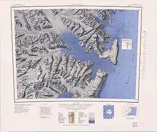
Mt Hart am nördlichen Rand des topographischen Kartenblatts | ||
| Höhe | 3000 m | |
| Lage | Viktorialand, Ostantarktika | |
| Gebirge | Admiralitätsberge, Transantarktisches Gebirge | |
| Koordinaten | 72° 5′ 0″ S, 169° 5′ 0″ O | |
| ||

Der United States Geological Survey kartierte ihn anhand eigener Vermessungen und Luftaufnahmen der United States Navy aus den Jahren von 1960 bis 1964. Das Advisory Committee on Antarctic Names benannte ihn 1970 nach Leutnant Vernon David Hart, leitender Offizier der Flugstaffel VX-6 auf der McMurdo-Station im antarktischen Winter 1968.
Weblinks
- Mount Hart im Geographic Names Information System des United States Geological Survey (englisch)
- Mount Hart auf geographic.org (englisch)
This article is issued from Wikipedia. The text is licensed under Creative Commons - Attribution - Sharealike. The authors of the article are listed here. Additional terms may apply for the media files, click on images to show image meta data.