Miller-Nunatak
Der Miller-Nunatak ist ein spitzer und 580 m hoher Nunatak im ostantarktischen Viktorialand. Er ragt 8 km ostsüdöstlich des Mount Dickason aus den Eismassen im unteren Abschnitt des Campbell-Gletschers auf.
| Miller-Nunatak | ||
|---|---|---|
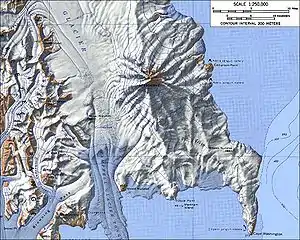
Topographische Karte des Campbell-Gletschers (Mitte) mit dem Miller-Nunatak | ||
| Höhe | 580 m | |
| Lage | Viktorialand, Ostantarktika | |
| Gebirge | Transantarktisches Gebirge | |
| Koordinaten | 74° 26′ 0″ S, 164° 15′ 0″ O | |
| ||

Der United States Geological Survey kartierte ihn anhand eigener Vermessungen und Luftaufnahmen der United States Navy aus den Jahren von 1955 bis 1963. Das Advisory Committee on Antarctic Names benannte ihn 1968 nach dem US-amerikanischen Biologen Herman Thomas Miller (* 1931), der von 1965 bis 1966 auf der McMurdo-Station tätig war.
Weblinks
- Miller Nunatak im Geographic Names Information System des United States Geological Survey (englisch)
- Miller Nunatak auf geographic.org (englisch)
This article is issued from Wikipedia. The text is licensed under Creative Commons - Attribution - Sharealike. The authors of the article are listed here. Additional terms may apply for the media files, click on images to show image meta data.