Mawson Escarpment
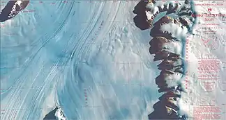
Das Mawson Escarpment ist eine abgeflachte und 112 km lange Geländestufe im ostantarktischen Mac-Robertson-Land. Die nach Westen ausgerichtete Formation erstreckt sich in nord-südlicher Ausdehnung entlang der Ostflanke des Lambertgletschers. An ihrer Nordspitze befindet sich die Barkell-Plattform.
| Mawson Escarpment | ||
|---|---|---|
 Satellitenaufnahme vom Mawson Escarpment (rechts) östlich des Lambertgletschers Satellitenaufnahme vom Mawson Escarpment (rechts) östlich des Lambertgletschers | ||
| Lage | Mac-Robertson-Land, Ostantarktika | |
| ||
| Koordinaten | 73° 7′ S, 68° 11′ O | |
John Michael Seaton, Flugoffizier der Royal Australian Air Force, entdeckte sie bei einem Erkundungsflug im Rahmen der Australian National Antarctic Research Expeditions im Jahr 1956. Das Antarctic Names Committee of Australia (ANCA) benannte sie nach dem australischen Polarforscher Douglas Mawson (1882–1958).
Weblinks
- Mawson Escarpment im Geographic Names Information System des United States Geological Survey (englisch)
- Mawson Escarpment auf geographic.org (englisch)
This article is issued from Wikipedia. The text is licensed under Creative Commons - Attribution - Sharealike. The authors of the article are listed here. Additional terms may apply for the media files, click on images to show image meta data.
