Matatufu
Matatufu ist ein Ort an der Südostspitze von Upolu in Samoa. Der Ort gehört zum Wahlbezirk (electoral constituency, Faipule District) Lotofaga Electoral Constituency im Distrikt Atua. 2006 hatte er 420 Einwohner.[1]
| Matatufu Matatufu | |||
|---|---|---|---|
| |||
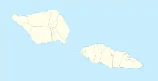
| Koordinaten | 14° 3′ S, 171° 35′ W | ||
| Basisdaten | |||
| Staat | Samoa | ||
| Atua | |||
| Einwohner | 420 (2006) | ||
Geographie
Matatufu liegt zusammen mit Leatupe an der Südküste, zwischen Sapo’e und Lotofaga an der Mündung des Vaisala Stream.[2] Im Ort befindet sich die Kirche EFKS Matatufu.
Klima
Das Klima ist tropisch heiß, wird jedoch von ständig wehenden Winden gemäßigt. Ebenso wie die anderen Orte in Samoa wird Matatufu gelegentlich von Zyklonen heimgesucht.
Einzelnachweise
- Population and Housing Census Report 2006. In: Samoa Bureau of Statistics. Juli 2008. Archiviert vom Original am 21. Juli 2011. Abgerufen am 19. Dezember 2009. 2016: 397 Einwohner.
- Matatufu bei GeoNames, geonames.org. Abgerufen am 18. Juli 2020.
This article is issued from Wikipedia. The text is licensed under Creative Commons - Attribution - Sharealike. The authors of the article are listed here. Additional terms may apply for the media files, click on images to show image meta data.