Macdougal Bay
Die Macdougal Bay ist eine kleine Bucht an der Nordküste von Laurie Island im Archipel der Südlichen Orkneyinseln. Sie wird im Westen durch die Ferguslie- und im Osten durch die Watson-Halbinsel eingefasst.
| Macdougal Bay | ||
|---|---|---|
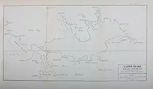 Karte von Laurie Island mit der Macdougal Bay (rechts oben) Karte von Laurie Island mit der Macdougal Bay (rechts oben) | ||
| Gewässer | Scotiasee | |
| Landmasse | Laurie Island, Südliche Orkneyinseln | |
| Geographische Lage | 60° 41′ 24″ S, 44° 33′ 21″ W | |
| ||

Teilnehmer der Scottish National Antarctic Expedition (1902–1904) kartierten die Bucht im Jahr 1903. Expeditionsleiter William Speirs Bruce benannte sie nach James Macdougal, dritter Maat auf dem Forschungsschiff Scotia.
Weblinks
- Macdougal Bay im Geographic Names Information System des United States Geological Survey (englisch)
- Macdougal Bay auf geographic.org (englisch)
This article is issued from Wikipedia. The text is licensed under Creative Commons - Attribution - Sharealike. The authors of the article are listed here. Additional terms may apply for the media files, click on images to show image meta data.