Lower Capitol
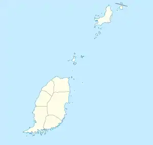
Lower Capitol ist eine Siedlung im Parish Saint Andrew im Zentrum von Grenada.
| Lower Capitol Lower Capitol | |||
|---|---|---|---|
| |||
| Koordinaten | 12° 7′ N, 61° 40′ W | ||
| Basisdaten | |||
| Staat | Grenada | ||
| Saint Andrew | |||
Geographie
Die Siedlung liegt im Inselinnern, im Tal des Balthazar Rivers auf ca. 165 m Höhe.[1] Im Umkreis liegen die Siedlungen Morne Longue, Castaigne, Nianganfoix, Birch Grove und Upper Capitol. Der umgebende Wald steht im Mount St. Catherine Forest Reserve unter Naturschutz.
Einzelnachweise
- Lower Capitol bei GeoNames, geonames.org. Abgerufen am 2021-12-17.
This article is issued from Wikipedia. The text is licensed under Creative Commons - Attribution - Sharealike. The authors of the article are listed here. Additional terms may apply for the media files, click on images to show image meta data.
