Liste der Inseln in Puerto Rico
Liste der Inseln in Puerto Rico (große Antillen)
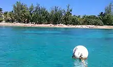
Cayo Lobos
.jpg.webp)
Cayo Aurora
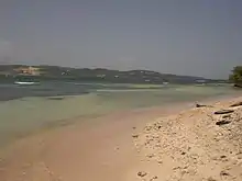
Cayo Caribe in Peñuelas
Der Commonwealth of Puerto Rico weist über 149 Inseln, Cays, Eilande und Atolle auf. Bewohnt ist die gleichnamige Hauptinsel, Vieques und Culebra sowie die Isla de Monahas (letztgenannte von Mitarbeitern des Department of Natural and Environmental Resources). Caja de Muertos ist ein Naturreservat des Department of Natural and Environmental Resources. Die Insel Desecheo ist ein Naturreservat, das vom United States Fish and Wildlife Service administriert wird.
Es gibt drei Privatinseln: Isla Palominos (genutzt als El Conquistador Hotel), Isla de Ramos und Isla de Lobos.
Liste
| Bezeichnung | GNIS ID | Koordinaten | Kommune | Geographische Breite | Geographische Länge | |
|---|---|---|---|---|---|---|
| Alcarraza | 1609495 | 18° 21′ 40″ N, 65° 22′ 9″ W | Culebra | |||
| Bajo Evelyn | 1612972 | Naguabo | 180905N | 0654428W | ||
| Cabeza de Perro | 1613398 | Ceiba | 181454N | 0653439W | ||
| Cabeza de Perro | 1609661 | Ceiba | 181453N | 0653441W | ||
| Cabezo de Perro | 1990733 | Ceiba | 181455N | 0653442W | ||
| Cayo Ahogado | 1609807 | Fajardo | 181921N | 0653710W | ||
| Cayo Alfeñique | 1613030 | Santa Isabel | 175537N | 0662107W | ||
| Cayo Algodones | 1609808 | Naguabo | 181134N | 0654101W | ||
| Cayo Arenas | 1609809 | Ponce | 175735N | 0664027W | ||
| Cayo Ballena | 1613031 | Culebra | 182051N | 0651413W | ||
| Cayo Batata | 1609810 | Humacao | 180656N | 0654617W | ||
| Cayo Bayo | 1609811 | Lajas | 175817N | 0670340W | ||
| Cayo Berbería[1] | 1609812 | Juana Díaz | 175543N | 0662725W | ||
| Cayo Botella | 1613032 | Culebra | 181930N | 0651427W | ||
| Cayo Botijuela | 2575431 | Culebra | 182225N | 0652237W | ||
| Cayo Cabritas | 1609813 | Ceiba | 181315N | 0653606W | ||
| Cayo Caracoles | 1609814 | Lajas | 175736N | 0670218W | ||
| Cayo Caribe | 1609815 | Peñuelas | 175812N | 0664358W | ||
| Cayo Chiva | 1612887 | Vieques | 180621N | 0652458W | ||
| Cayo Collado | 1609816 | Lajas | 175745N | 0670208W | ||
| Cayo Conejo | 2575421 | - | 180727N | 0651830W | ||
| Cayo Corral | 1613034 | Lajas | 175609N | 0670110W | ||
| Cayo Desgraciado | 2575420 | Ponce | 175757N | 0663356W | ||
| Cayo Diablo | 1609817 | Fajardo | 182145N | 0653153W | ||
| Cayo Don Luis | 1609818 | Guánica | 175638N | 0665818W | ||
| Cayo Enrique | 1609819 | Lajas | 175712N | 0670248W | ||
| Cayo Fanduca | 1613035 | Cabo Rojo | 180513N | 0671254W | ||
| Cayo Icacos | 1613037 | Fajardo | 182311N | 0653520W | ||
| Cayo Jalova | 1609820 | Vieques | 180707N | 0652132W | ||
| Cayo Jalovita | 1609821 | Vieques | 180657N | 0652117W | ||
| Cayo Largo | 1609822 | Fajardo | 181855N | 0653443W | ||
| Cayo Lobito | 1613038 | Culebra | 182003N | 0652334W | ||
| Cayo Lobo | 1613039 | Culebra | 181928N | 0652239W | ||
| Cayo Lobos | 1609823 | Fajardo | 182239N | 0653412W | ||
| Cayo María Langa | 1613040 | Guayanilla | 175756N | 0664501W | ||
| Cayo Mata | 1609825 | Guayanilla | 175921N | 0664549W | ||
| Cayo Mata | 1609824 | Salinas | 175711N | 0661740W | ||
| Cayo Mata Seca | 1613041 | Lajas | 175740N | 0670034W | ||
| Cayo Matias | Salinas | |||||
| Cayo Matojo | 1613042 | 18° 20′ 11″ N, 65° 17′ 24″ W | Culebra | 182011N | 0651724W | |
| Cayo Morrillo | 1609826 | Salinas | 175537N | 0661623W | ||
| Cayo Norte | 1613043 | Culebra | 182013N | 0651524W | ||
| Cayo Obispo | Fajardo | |||||
| Cayo Palomas | 1609827 | Peñuelas | 175829N | 0664456W | ||
| Cayo Parguera | 1609828 | Peñuelas | 175843N | 0664303W | ||
| Cayo Pirata | 1613044 | Culebra | 181823N | 0651744W | ||
| Cayo Piñerito | 1609829 | Ceiba | 181442N | 0653541W | ||
| Cayo Puerca | 1613045 | Salinas | 175546N | 0661413W | ||
| Cayo Ratones | 1609831 | Fajardo | 182257N | 0653449W | ||
| Cayo Ratones | 1609830 | Cabo Rojo | 180701N | 0671118W | ||
| Cayo Ratón | 1613046 | Culebra | 181851N | 0652112W | ||
| Cayo Real | 1613027 | Vieques | 180519N | 0652822W | ||
| Cayo Río | 1613048 | Peñuelas | 175857N | 0664417W | ||
| Cayo Santiago | 1609832 | 18° 9′ 23″ N, 65° 44′ 1″ W | Humacao | 180923N | 0654403W | |
| Cayo Sombrerito | 1613049 | Culebra | 182016N | 0651444W | ||
| Cayo Terremoto | 1612960 | Guánica | 175548N | 0665821W | ||
| Cayo Tiburón | 1613050 | Culebra | 182042N | 0651417W | ||
| Cayo Tuna | 2575419 | Culebra | 182015N | 0652335W | ||
| Cayo Verde | 1613051 | Culebra | 181825N | 0651726W | ||
| Cayo Vieques | 1609833 | Lajas | 175751N | 0670415W | ||
| Cayo Yerba | 1613052 | 18° 19′ 8″ N, 65° 21′ 14″ W | Culebra | 181908N | 0652114W | |
| Cayo de Luis Peña | 1613028 | Culebra | 181823N | 0651959W | ||
| Cayo de Tierra | 1612886 | Vieques | 180520N | 0652802W | ||
| Cayo del Agua | 1992542 | Culebra | 181840N | 0652051W | ||
| Cayo del Agua | 1613029 | Culebra | 181843N | 0652052W | ||
| Cayos Cabezazos | 1613054 | Santa Isabel | 175518N | 0662259W | ||
| Cayos Caribes | 1613055 | Guayama | 175538N | 0661244W | ||
| Cayos Geniquí | 1613057 | Culebra | 182018N | 0651354W | ||
| Cayos de Barca | 1609834 | Salinas | 175459N | 0661423W | ||
| Cayos de Caracoles | 1613053 | Santa Isabel | 175542N | 0662159W | ||
| Cayos de Caña Gorda | 1609835 | Guánica | 175632N | 0665217W | ||
| Cayos de Pájaros | 1609836 | Salinas | 175524N | 0661540W | ||
| Cayos de Ratones | 1609837 | Salinas | 175606N | 0661734W | ||
| El Ancón | 1613383 | Culebra | 182106N | 0652035W | ||
| El Mono | 1610244 | Culebra | 181904N | 0652206W | ||
| Gata Islets | 2575433 | Ponce | 175800N | 0663700W | ||
| Cayo Aurora (Gilligans Island) | 1992706 | Guánica | 175633N | 0665216W | ||
| Isla Ballena | 1991536 | Guánica | 175641N | 0665201W | ||
| Isla Cabras | 1611178 | Ceiba | 181244N | 0653609W | ||
| Isla Caja de Muertos | 1611179 | Ponce | 175341N | 0663112W | ||
| Isla Chiva | 1612909 | Vieques | 180626N | 0652303W | ||
| Isla Cueva | 1611180 | Lajas | 175744N | 0670449W | ||
| Isla Culebrita | 1611181 | Culebra | 181853N | 0651344W | ||
| Isla Desecheo | 2575416 | Mayagüez | 182320N | 0672830W | ||
| Isla Guachinanga | 1611183 | San Juan | 182548N | 0660208W | ||
| Isla Guayacán | 1611184 | Lajas | 175727N | 0670525W | ||
| Isla La Cancora | 1611185 | Loíza | 182757N | 0655951W | ||
| Isla Magueyes | 1611186 | Lajas | 175808N | 0670239W | ||
| Isla Mata la Gata | Lajas | |||||
| Isla Matei | 1611187 | Lajas | 175804N | 0670028W | ||
| Isla Monito | 1613131 | Mayagüez | 180941N | 0675659W | ||
| Isla Morrillito | 1611189 | Ponce | 175256N | 0663200W | ||
| Isla Palominitos | 1611190 | Fajardo | 182020N | 0653402W | ||
| Isla Palominos | 1611191 | Fajardo | 182055N | 0653405W | ||
| Isla Piedra | 1611192 | San Juan | 182753N | 0660242W | ||
| Isla Piñeros[2] | 1613132 | Ceiba | 181508N | 0653529W | ||
| Isla Puerca | 1611193 | Santa Isabel | 175733N | 0662148W | ||
| Isla San Juan | 1613356 | Bayamón | 182758N | 0660614W | ||
| Isla Verde | 1611194 | Carolina | 182653N | 0660100W | ||
| Isla Yallis | 1612911 | Vieques | 180853N | 0651833W | ||
| Isla de Cabras | 1611175 | Toa Baja | 182815N | 0660811W | ||
| Isla de Cardona | 1613033 | Ponce | 175726N | 0663806W | ||
| Isla de Cerro Gordo | 1611176 | Vega Alta | 182911N | 0662056W | ||
| Isla de Culebra | 1611182 | Culebra | 181853N | 0651659W | ||
| Isla de Jueyes | 2575428 | Ponce | 175740N | 0663524W | ||
| Isla de Mona | 1611188 | 18° 4′ 53″ N, 67° 53′ 29″ W | Mayagüez | 180453N | 0675329W
200 | |
| Isla de Ramos | 1611177 | Fajardo | 181846N | 0653635W | ||
| Isla de Ratones | 1613047 | Ponce | 175711N | 0664052W | ||
| Isla de Vieques | 1612910 | Vieques | 180723N | 0652459W | ||
| Isla de las Palomas | 1611174 | Toa Baja | 182834N | 0661119W | ||
| Isla del Frio | 1613056 | Ponce | 175744N | 0663319W | ||
| Island of Puerto Rico | 1848460 | Orocovis | 181458N | 0663004W | ||
| Isleta Marina | 2575427 | 18° 20′ 23″ N, 65° 37′ 5″ W | Fajardo | 182023N | 0653705W | |
| Isleta de San Juan | 1991538 | San Juan | 182751N | 0660551W | ||
| Isletas de Garzas | 1611196 | Vega Baja | 182923N | 0662229W | ||
| Islote Número dos | 1613133 | Carolina | 182628N | 0655842W | ||
| Islote de Juan Pérez | 1611198 | Loíza | 182610N | 0655604W | ||
| La Blanquilla | 1611235 | Fajardo | 182216N | 0653314W | ||
| La Cordillera | 1611243 | Fajardo | 182253N | 0653359W | ||
| Las Cabritas | 1611352 | Toa Baja | 182824N | 0660804W | ||
| Las Cucarachas | 1611365 | Fajardo | 182402N | 0653642W | ||
| Las Hermanas | 1611370 | Culebra | 181853N | 0652109W | ||
| Las Lavanderas | 2575426 | 181600N | 0653300W | |||
| Las Lavanderas del Este | 1611371 | Ceiba | 181555N | 0653223W | ||
| Las Lavanderas del Oeste | 1611372 | Ceiba | 181543N | 0653333W | ||
| Los Farallones | 1611428 | Fajardo | 182353N | 0653554W | ||
| Los Gemelos | 1611429 | Culebra | 182131N | 0652142W | ||
| Los Negritos | 1611437 | Arecibo | 182936N | 0663617W | ||
| Mata Redonda | 1611489 | Guayama | 175703N | 0661222W | ||
| Pelaíta | 1613156 | Culebra | 181758N | 0651509W | ||
| Pelá | 1613155 | Culebra | 181751N | 0651501W | ||
| Peñon Brusi | 1611647 | Camuy | 182933N | 0665118W | ||
| Peñon de Afuera | 1611645 | Camuy | 182934N | 0665210W | ||
| Peñon de San Jorge | 1611646 | San Juan | 182811N | 0660529W | ||
| Piedra Stevens | 1613163 | Culebra | 182131N | 0652051W | ||
| Piedra del Norte | 1613162 | 18° 19′ 15″ N, 65° 13′ 24″ W | Culebra | 181915N | 0651324W | |
| Piragua de Adentro | 1611675 | Ceiba | 181606N | 0653153W | ||
| Piragua de Afuera | 1613390 | Ceiba | 181622N | 0653032W | ||
| Piragua de Afuera | 1611676 | Ceiba | 181622N | 0653033W | ||
| Punta Larga | 1611824 | Loíza | 182650N | 0655855W | ||
| Punta Mosquitos | 1611840 | Loíza | 182641N | 0655833W | ||
| Roca Alcatraz | 1612949 | Vieques | 180724N | 0651804W | ||
| Roca Cocinera | 1612633 | Arecibo | 182848N | 0664214W | ||
| Roca Cucaracha | 1612950 | 18° 9′ 17″ N, 65° 19′ 22″ W | Vieques | 180917N | 0651922W | |
| Roca Culumna | 1613382 | Culebra | 181958N | 0652331W | ||
| Roca Ola | 1612636 | Cabo Rojo | 175651N | 0671056W | ||
| Roca Resuello | 1612637 | Arecibo | 182842N | 0664306W | ||
| Roca Speck | 1613369 | Culebra | 181935N | 0651550W | ||
| Roca Velásquez | 1612638 | 18° 1′ 24″ N, 67° 10′ 40″ W | Cabo Rojo | 180124N | 0671040W | |
| Tres Hermanas | 1612790 | Barceloneta | 182928N | 0663428W | ||
| Tres Hermanos | 1612791 | Arecibo | 182854N | 0664212W |
Weblinks
Commons: Inseln in Puerto Rico – Sammlung von Bildern, Videos und Audiodateien
Einzelnachweise
- Puerto Rico and Virgin Islands NOAA Chart 25640. In: NOAA. NOAA. Abgerufen am 29. Oktober 2020.
- ENVIRONMENTAL ASSESSMENT OF TRAINING ACTIVITIES ON PINEROS AND CABEZA DE PERRO ISLANDS, U.S. NAVAL STATION ROOSEVELT ROADS (PDF) DEPARTMENT OF THE NAVY, Atlantic Division, Naval Facilities Engineering Command. S. 1–2. Abgerufen am 18. Dezember 2021.
This article is issued from Wikipedia. The text is licensed under Creative Commons - Attribution - Sharealike. The authors of the article are listed here. Additional terms may apply for the media files, click on images to show image meta data.