Las Palmas (Deception Island)
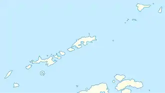
Las Palmas ist ein Unterwasserplateau 24 m unter dem Meeresspiegel im Port Foster von Deception Island im Archipel der Südlichen Shetlandinseln. Es liegt nördlich der spanischen Gabriel-de-Castilla-Station vor der Einfahrt zur Primero de Mayo Bay.
| Las Palmas | ||
| Geographische Lage | ||
| ||
| Koordinaten | 62° 58′ 15″ S, 60° 40′ 26″ W | |
| Gewässer 1 | Port Foster (Deception Island) | |
Spanische Wissenschaftler benannten es nach dem spanischen Forschungsschiff Las Palmas, das hier bei elf Antarktisfahrten zur Versorgung der Forschungsstation vor Anker ging.
Weblinks
- Las Palmas im Composite Gazetteer of Antarctica (englisch)
This article is issued from Wikipedia. The text is licensed under Creative Commons - Attribution - Sharealike. The authors of the article are listed here. Additional terms may apply for the media files, click on images to show image meta data.
