Larsøya
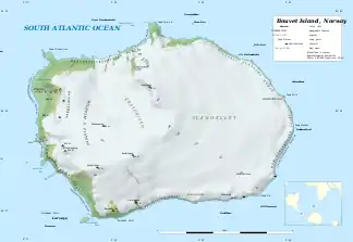
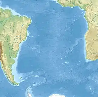
Larsøya, auch Lars Island oder Lars-Insel, ist eine felsige Insel, die wenige hundert Meter vor der südwestlichen Landspitze Catoodden der Bouvetinsel im Südatlantik liegt.[1] Die Insel ist rund 340 Meter lang und bis zu 190 Meter breit.
| Larsøya | ||
|---|---|---|
| Gewässer | Südatlantik | |
| Geographische Lage | 54° 27′ 11″ S, 3° 18′ 54″ O | |
| ||
| Länge | 340 m | |
| Breite | 190 m | |
| Fläche | 4 ha | |
| Höchste Erhebung | 2 m | |
| Einwohner | unbewohnt | |
 Karte der Bouvetinsel mit der Larsøya (links unten) | ||
Sie wurde erstmals 1898 von der deutschen Valdivia-Expedition unter Carl Chun kartiert. Eine norwegische Expedition unter Kapitän Harald Horntvedt (1879–1946) landete im Dezember 1927 auf der Insel und benannte sie nach Lars Christensen, dem Sponsor der Expedition.
Weblinks
- Larsøya auf der Website des Norwegischen Polarinstituts (englisch)
- Yr.no - Norwegian Meteorological Institute and NRK - Larsøya
Einzelnachweise
- Antarctica Detail. Geographic Names Information System (GNIS), abgerufen am 27. August 2017 (englisch).
This article is issued from Wikipedia. The text is licensed under Creative Commons - Attribution - Sharealike. The authors of the article are listed here. Additional terms may apply for the media files, click on images to show image meta data.
