Khomashochland
Das Khomashochland (auch Khomas-Hochland oder Komashochland) ist das namensgebende Gebirge der Khomasregion, in der auch Windhoek, die Hauptstadt Namibias liegt. „Khomas“ kommt von Khoekhoegowab „L Omas“ und bedeutet bergig.[1]
| Khomashochland | ||
|---|---|---|
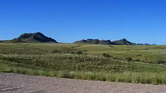 beim Gamsberg beim Gamsberg | ||
| Höchster Gipfel | Gamsberg (2347 m) | |
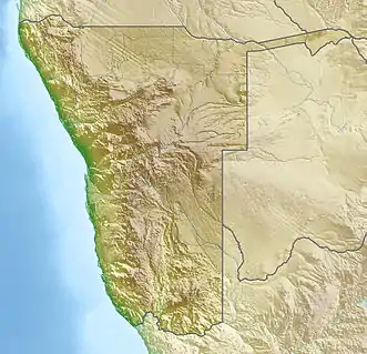
| Lage | Khomas, Namibia | |
| ||
| Koordinaten | 22° 40′ S, 16° 20′ O | |
| Besonderheiten | vierthöchstes Gebirge Namibias | |
Das Khomashochland hat eine durchschnittliche Höhe von 2000 m und erstreckt sich in westlicher Richtung bis zum Gamsberg, wo es an der so genannten Großen Randstufe rund 1000 m in die Namibwüste abfällt. Das Khomashochland schließt jedoch weitere Gebiete mit ein, vor allem den nördlichen Teil der Region Omaheke mit Ausläufern bis in den Ghanzi District in Botswana. Es ist Teil des „Zentralen Hochlands“ Namibias. Seine höchste Erhebung ist der in den Hakosbergen gelegene Gamsberg. In der Nähe des Gamsberges befinden sich auch die H.E.S.S. Teleskope.
Literatur
- Stichwort: Komashochland. Online in: Deutsches Kolonial-Lexikon, Band II, Leipzig 1920, S. 348.
Einzelnachweise
- Geology. Landscapes Namibia. Abgerufen am 28. Juni 2017.