Kap Jones
Das Kap Jones bildet die Südspitze der Daniell-Halbinsel an der Borchgrevink-Küste des ostantarktischen Viktorialands. Es liegt unmittelbar südöstlich des Mount Lubbock und bildet die östliche Begrenzung der nördlichen Einfahrt vom Rossmeer in die Glacier Strait.
| Kap Jones | ||
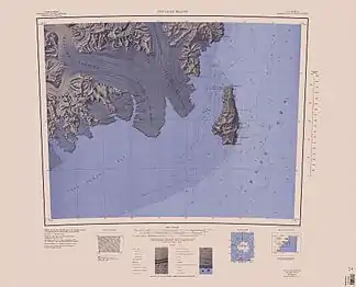 Karte der Südspitze der Daniell-Halbinsel (Mitte oben) mit Kap Jones | ||
| Geographische Lage | ||
| ||
| Koordinaten | 73° 17′ S, 169° 13′ O | |
| Lage | Viktorialand, Ostantarktika | |
| Küste | Borchgrevink-Küste | |
| Gewässer | Rossmeer | |
| Gewässer 2 | Glacier Strait | |

Der britische Polarforscher James Clark Ross entdeckte es im Januar 1841 bei seiner Antarktisexpedition (1839–1843). Ross benannte das Kap nach Kapitän William Jones (<1805–1846) von der Royal Navy.
Weblinks
- Cape Jones im Geographic Names Information System des United States Geological Survey (englisch)
- Cape Jones auf geographic.org (englisch)
This article is issued from Wikipedia. The text is licensed under Creative Commons - Attribution - Sharealike. The authors of the article are listed here. Additional terms may apply for the media files, click on images to show image meta data.