Johnsons Dock
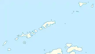
Johnsons Dock (auch bekannt als Johnson’s Dock, Jonson’s Dock, Johnson Dock, Johnson Harbour, Johnson’s Harbour und Jones Basin, in Argentinien Fondeadero Johnson, in Chile Dársena Johnson) ist eine Nebenbucht der South Bay an der Südküste der Livingston-Insel im Archipel der Südlichen Shetlandinseln. Sie liegt im östlichen Teil der South Bay an der Westküste der Hurd-Halbinsel.
| Johnsons Dock | ||
|---|---|---|
 Blick vom Charrúa Ridge auf das Johnsons Dock mit dem Ballester Point (Mitte) Blick vom Charrúa Ridge auf das Johnsons Dock mit dem Ballester Point (Mitte) | ||
| Gewässer | South Bay, Bransfieldstraße | |
| Landmasse | Livingston-Insel, Südliche Shetlandinseln | |
| Geographische Lage | 62° 39′ 37″ S, 60° 22′ 3″ W | |
| ||
| Zuflüsse | Contell-Gletscher, Johnsons-Gletscher | |
Der Name ist seit etwa 1821 bekannt. Als Namensgeber kommen mehrere Personen in Frage. Eine davon ist Kapitän Robert Johnson, der mit dem Robbenfänger Jane Maria zwischen 1820 und 1821 vor den Südlichen Shetlandinseln operierte.
Literatur
- John Stewart: Antarctica – An Encyclopedia. Bd. 1, McFarland & Co., Jefferson und London 2011, ISBN 978-0-7864-3590-6, S. 821 (englisch)
Weblinks
- Johnsons Dock im Geographic Names Information System des United States Geological Survey (englisch)
- Johnsons Dock auf geographic.org (englisch)
This article is issued from Wikipedia. The text is licensed under Creative Commons - Attribution - Sharealike. The authors of the article are listed here. Additional terms may apply for the media files, click on images to show image meta data.
