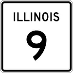
Illinois State Route 9
Die Illinois State Route 9 (kurz IL 9) ist eine in Ost-West-Richtung verlaufende State Route im US-Bundesstaat Illinois.

| |
|---|---|
| Basisdaten | |
| Gesamtlänge: | 190 mi/306 km |
| Eröffnung: | 1918 |
| Anfangspunkt: | |
| Endpunkt: | |
| Countys: | Vermilion County Ford County McLean County Tazewell County Peoria County Fulton County McDonough County Hancock County |
| Wichtige Städte: | La Harpe Bushnell Canton Pekin Bloomington Gibson City Paxton Hoopeston |
Verlauf
Die zum größten Teil aus zwei Fahrspuren bestehende State Route beginnt an der Indiana State Route 26 nahe Cheneyville und endet nahe Fort Madison am Iowa Highway 2.
Sie ist eine wichtige Verkehrsader und verläuft parallel zur Illinois State Route 116 im Norden und dem U.S. Highway 136 im Süden. Sie trifft bei Paxton auf die Interstate 57 und bei Bloomington auf die Interstates 55 und 74 sowie bei Tremont auf die Interstate 155.
In der Nähe von Pekin führt die State Route über den Illinois River.
Weblinks
- Illinois Highway Ends (englisch)
- Illinois Highways (englisch)
This article is issued from Wikipedia. The text is licensed under Creative Commons - Attribution - Sharealike. The authors of the article are listed here. Additional terms may apply for the media files, click on images to show image meta data.