Harris Point
Der Harris Point ist eine felsige Landspitze an der Shackleton-Küste der antarktischen Ross Dependency. Sie markiert die Südseite des Zugangs vom Ross-Schelfeis zur Beaumont Bay.
| Harris Point | ||
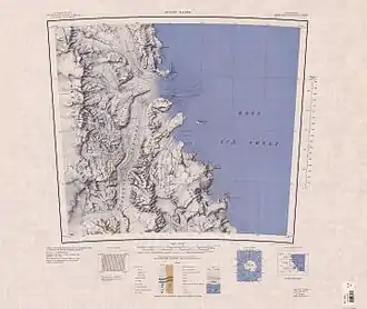
 Kartenblatt mit dem Harris Point an der Südseite der Beaumont Bay | ||
| Geographische Lage | ||
| ||
| Koordinaten | 81° 35′ S, 161° 32′ O | |
| Lage | Ross Dependency, Antarktika | |
| Küste | Shackleton-Küste | |
| Gewässer | Ross-Schelfeis | |
| Gewässer 2 | Beaumont Bay | |
Das Advisory Committee on Antarctic Names benannte sie 1965 nach Herman David Harris (* 1918), leitender Sanitätsoffizier der United States Navy bei der Flugstaffel VX-6, der im Rahmen der Operation Deep Freeze von 1961 ein Lazarett auf der Amundsen-Scott-Südpolstation errichtet hatte.[1]
Weblinks
- Harris Point im Geographic Names Information System des United States Geological Survey (englisch)
- Harris Point auf geographic.org (englisch)
Einzelnachweise
- John Stewart: Antarctica – An Encyclopedia. Bd. 1, McFarland & Co., Jefferson und London 2011, ISBN 978-0-7864-3590-6, S. 700 (englisch).
This article is issued from Wikipedia. The text is licensed under Creative Commons - Attribution - Sharealike. The authors of the article are listed here. Additional terms may apply for the media files, click on images to show image meta data.
