Gila Mountains
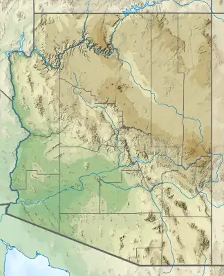
Die Gila Mountains [ˈhiːlə ˈmaʊntn̩z] sind ein 2750 km² großes Gebirge im Graham County im US-Bundesstaat Arizona in den Central Arizona Highlands. Es hat eine Ausdehnung von 72 km von Nord nach Süd und 88 km von Ost nach West. Der höchste Punkt ist der Bryce Mountain mit einer Höhe von 2219 m gefolgt vom Gila Peak mit einer Höhe von 2021 m.[1][2]
| Gila Mountains | ||
|---|---|---|
| Höchster Gipfel | Bryce Mountain (2219 m) | |
| Lage | Graham County in Arizona (USA) | |
| Teil der | Central Arizona Highlands | |
| ||
| Koordinaten | 33° 1′ N, 109° 40′ W | |
| Fläche | 2.750 km² | |
Siehe auch
- Gila Mountains (Yuma County) im Yuma County (Arizona)
Einzelnachweise
This article is issued from Wikipedia. The text is licensed under Creative Commons - Attribution - Sharealike. The authors of the article are listed here. Additional terms may apply for the media files, click on images to show image meta data.