Eastface-Nunatak
Der Eastface-Nunatak ist ein kleiner Nunatak an der nördlichen Hillary-Küste des ostantarktischen Viktorialands. Er ragt 17,5 km südlich des Mount Morning auf.
| Eastface-Nunatak | ||
|---|---|---|
| Lage | Viktorialand, Ostantarktika | |
| Gebirge | Transantarktisches Gebirge | |
| Koordinaten | 78° 42′ 0″ S, 163° 38′ 0″ O | |
| ||
| Normalweg | Hochtour (vergletschert) | |
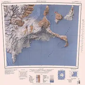
Kartenblatt Mount Discovery von 1962 (Neuauflage 1988), Eastface Nunatak an der Küste südlich des Gipfels von Mount Morning | ||

Der United States Geological Survey kartierte ihn anhand eigener Vermessungen und Luftaufnahmen der United States Navy. Das Advisory Committee on Antarctic Names benannte ihn 1963 nach seiner markanten und felsigen Ostflanke.
Weblinks
- Eastface Nunatak im Geographic Names Information System des United States Geological Survey (englisch)
- Eastface Nunatak auf geographic.org (englisch)
This article is issued from Wikipedia. The text is licensed under Creative Commons - Attribution - Sharealike. The authors of the article are listed here. Additional terms may apply for the media files, click on images to show image meta data.