Dump (Belize)
Dump ist ein Ort im Toledo District in Belize. 2010 hatte der Ort 198 Einwohner.[1]
| Dump Dump | |||
|---|---|---|---|
| |||
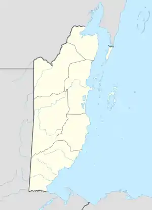
| Koordinaten | 16° 14′ N, 88° 56′ W | ||
| Basisdaten | |||
| Staat | Belize | ||
| Toledo | |||
| Höhe | 34 m | ||
| Einwohner | 198 (2010) | ||
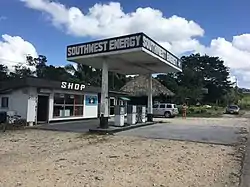
 Tankstelle in Dump Tankstelle in Dump | |||
Geographie
Dump liegt etwa 20 km nordwestlich und landeinwärts zum Hauptort Punta Gorda am Southern Highway.[2] Der Fluss Columbia Branch, der 3 km nördlich verläuft, entwässert zum Rio Grande.
Die Nachbarorte sind San Pedro Columbia, San Miguel (N), Silver Creek, Big Falls (NO), Pine Hill (O), San Marcos, Yemeri Grove (SO), Laguna (S), Jordan, Blue Creek (SW) und Mafredi (NW).
Bildung
Im Ort gibt es zwei weiterführende Schulen: das Centre for Employment Training und die Julian Cho Technical High School.[3]
Klima
Das Klima ist tropisch heiß.[4]
Weblinks
Commons: Dump (Belize) – Sammlung von Bildern, Videos und Audiodateien
Einzelnachweise
- Zensus 2010 (PDF; 2,6 MB) sib.org.bz, Statistical Institute of Belize. Abgerufen am 9. Dezember 2020.
- Dump bei GeoNames, geonames.org. Abgerufen am 9. Dezember 2020.
- Environmental Impact Assessment Report. In: Southern Highway Upgrading Project: Mile 14 to Guatemala Border. Ministry of Works and Transport: Government of Belize. Mai 2002. Abgerufen am 4. Juni 2013.
- Directory of Cities and Towns in Toledo District, Belize. fallingrain.com. Abgerufen am 4. Juni 2013.
This article is issued from Wikipedia. The text is licensed under Creative Commons - Attribution - Sharealike. The authors of the article are listed here. Additional terms may apply for the media files, click on images to show image meta data.
