Doppelkuppe
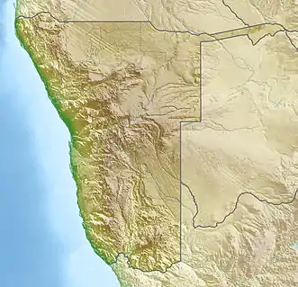
Die Doppelkuppe ist ein Berg in der Hardap-Region im Südwesten Namibias. Er erreicht eine Höhe von 1862 m. Die Doppelkuppe liegt etwa fünf Kilometer westlich der D707 und etwa 13 km westlich der Hauptstraße C27 am Ostrande der Namib.[1]
| Doppelkuppe | ||
|---|---|---|
.jpg.webp) Doppelkuppe am Horizont der linken Bildhälfte (2017) Blick in Richtung Osten Bildaufnahme bei: 25°36′31″S 016°06′24″E Doppelkuppe am Horizont der linken Bildhälfte (2017) | ||
| Höchster Gipfel | 1862[1] | |
| Lage | Hardap, | |
| ||
| Koordinaten | 25° 34′ S, 16° 12′ O | |
Weblinks
Commons: Doppelkuppe – Sammlung von Bildern, Videos und Audiodateien
- Doppelkuppe, auf PeakVisor (englisch)
Einzelnachweise
- Namibia Travel Map. Kunth-Verlag, München 2017, ISBN 978-3-95504-578-4.
This article is issued from Wikipedia. The text is licensed under Creative Commons - Attribution - Sharealike. The authors of the article are listed here. Additional terms may apply for the media files, click on images to show image meta data.