Corinthian Bay
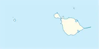
Die Corinthian Bay ist eine Bucht an der Nordküste der Insel Heard. Sie liegt zwischen dem Rogers Head und dem Saddle Point.
| Corinthian Bay | ||
|---|---|---|
| Gewässer | Indischer Ozean | |
| Landmasse | Heard (Heard und McDonaldinseln) | |
| Geographische Lage | 53° 1′ 0″ S, 73° 27′ 0″ O | |
| ||
| Breite | 5 km | |
| Tiefe | 2,5 km | |
| Inseln | Carroll Rock, Church Rock | |
| Zuflüsse | Baudissin-Gletscher, Nares-Gletscher, Mary-Powell-Gletscher | |
Der Name der Bucht geht auf US-amerikanische Robbenjäger zurück, welche die Insel Heard seit 1855 ansteuerten. Wahrscheinlich benannte Kapitän Erasmus Darwin Rogers (1817–1906) die Bucht nach seinem Schiff Corinthian, mit dem er die Insel erstmals im März 1855 anlief.
Weblinks
- Corinthian Bay im Geographic Names Information System des United States Geological Survey (englisch)
- Corinthian Bay auf geographic.org (englisch)
This article is issued from Wikipedia. The text is licensed under Creative Commons - Attribution - Sharealike. The authors of the article are listed here. Additional terms may apply for the media files, click on images to show image meta data.
