Copland Peak
Der Copland Peak ist ein rund 500 m hoher Berg im Südwesten der westantarktischen Alexander-I.-Insel. Er ragt 5 km nordöstlich der Mussorgsky Peaks auf der Derocher-Halbinsel auf.
| Copland Peak | ||
|---|---|---|

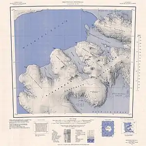
Topographisches Kartenblatt (1:250.000) mit der Derocher-Halbinsel (Mitte rechts) und dem darauf befindlichen Copland Peak | ||
| Höhe | 500 m | |
| Lage | Alexander-I.-Insel, Westantarktika | |
| Koordinaten | 71° 27′ 15″ S, 73° 15′ 55″ W | |
| ||
| Normalweg | Hochtour (vergletschert) | |
Der United States Geological Survey kartierte ihn anhand Luftaufnahmen der United States Navy aus den Jahren von 1967 bis 1968 sowie mittels Landsat-Aufnahmen von 1972 und 1973. Das Advisory Committee on Antarctic Names benannte ihn 1988 nach dem US-amerikanischen Komponisten Aaron Copland (1900–1990).
Weblinks
- Copland Peak im Geographic Names Information System des United States Geological Survey (englisch)
- Copland Peak auf geographic.org (englisch)
This article is issued from Wikipedia. The text is licensed under Creative Commons - Attribution - Sharealike. The authors of the article are listed here. Additional terms may apply for the media files, click on images to show image meta data.
