Cobham Range
Die Cobham Range ist ein Gebirgszug im südlichen Teil der Churchill Mountains im Transantarktischen Gebirge. Die Range erstreckt sich in nordwest-südöstlicher Richtung über 32 km westlich des Prinz-Philip-Gletschers.
| Cobham Range | ||
|---|---|---|
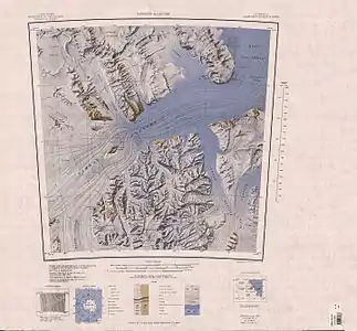 Topographische Karte mit der Cobham Range (links der Mitte) Topographische Karte mit der Cobham Range (links der Mitte) | ||
| Höchster Gipfel | Lyttelton Peak (2335 m) | |
| Lage | Ross Dependency, Antarktika | |
| Teil der | Churchill Mountains, Transantarktischen Gebirges | |
| ||
| Koordinaten | 82° 18′ S, 159° 0′ O | |

Das New Zealand Antarctic Place-Names Committee benannte ihn nach Charles Lyttelton, 10. Viscount Cobham (1909–1977), Generalgouverneur von Neuseelands von 1957 bis 1962.
Weblinks
- Cobham Range im Geographic Names Information System des United States Geological Survey (englisch)
- Cobham Range auf geographic.org (englisch).
This article is issued from Wikipedia. The text is licensed under Creative Commons - Attribution - Sharealike. The authors of the article are listed here. Additional terms may apply for the media files, click on images to show image meta data.